Geokosmos is one of the world leaders in the area of geospatial data collection applying LiDAR and digital aerial imaging technologies. At the same time Geokosmos has always been committed to better performance. Guided by the customers’ need to have a fast way of reviewing and analyzing raw survey data collected by means of LiDAR and digital aerial imaging technologies, the Company developed in 2003 its own software called Geokosmos 3D Modeler.
Eventually Geokosmos 3D Modeler functionality has significantly been enhanced and from now on the product is recognized as a tool for creation of maps and 3D photorealistic digital surface models based on the combination of LiDAR and digital aerial imaging data. Apart from that the software allows to solve a number of basic topographic tasks.
The most significant application tasks are as follows:
-
Creation of 3D photorealistic digital surface models
-
Terrain and engineering objects modeling
-
Surface analysis and objects interpretation
-
Creation of topographic maps (including 3D maps)
-
Creation of profiles and cross-sections
The Company has been successfully using Geokosmos 3D Modeler, its application has fully met the Company’s expectations and, what is most important, the software is acknowledged by Geokosmos customers, colleagues and partners. The key factor in this connection is high speed of large volume data processing, user friendly format, smooth integration of our software into the work cycle, compliance of results with the existing requirements. As a result, Geokosmos 3D Modeler makes the production cycle cost-efficient.
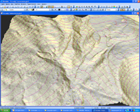 |  |
| DTM with contour lines | DTM with profiles |
 |  |
|
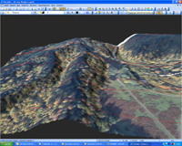
3D photorealistic digital surface model, buildings |
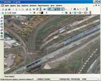
3D photorealistic digital surface model, railway station |
 |  |
|
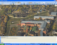
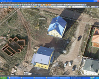
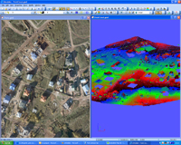
3D photorealistic digital surface model, cottages | Raw data representation |