Laser Scanning
A laser image is multitude of points on the ground surface (laser points) that reflect laser beams emitted by a laser locator. Every point has its specific spatial coordinates X, Y, Z. All taken together, laser points from a certain image of a scene being observed, and it is this image that is defined as a laser image or a cloud of laser points. Than collected laser data could be used for creating Digital Terrain Models and Digital Surface Models. There are airborne and terrestrial laser scanners; accordingly there are airborne and terrestrial laser scanning technologies.
Airborne Laser Scanning
Terrestrial Laser Scanning
Airborne Laser Scanning
Airborne Laser Scanning carries out at a height of 500-1500 meters. Laser scanning accuracy depends on cruising altitude. Average accuracy of spatial coordinate measurements is 15 cm, maximum achievable accuracy up to 5 cm.
|
Applications:
- land management
- urban planning
- power lines and substations planning, design and renovation
- highway and railway construction
- forestry management
- environmental monitoring
- risk management
| 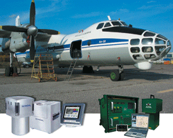 |
| Airborne laser scanning equipment |
Technology advantages:
- true relief (ground surface) canopy in any season
- location and shape of high-tech engineering facilities, pipelines, buildings,etc.
- detailed topographic pians and maps of territories without landmarks (tundra, completely snow covered areas, deserts, sand beaches, etc.)
- very high level of accuracy
- totally digital data flow
Airborne laser scanners are often used in combination with medium scale digital photo cameras. In this case, digital aerial images are taken concurrently with laser scanning from the same aircraft. Collected laser data could be used for imagery correction to produce true orthophoto.
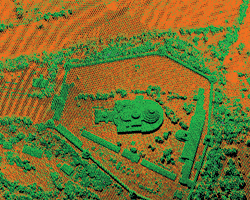 | 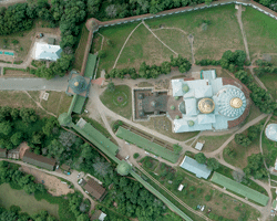 |
| Cloud of laser points | Digital aerial image |
Terrestrial Laser Scanning
Terrestrial Laser Scanning allows a greater density and accuracy of laser reflection points and, therefore, a higher degree of detail of survey. Terrestrial Laser Scanning can be used to survey and generate models of terrain and areas where all microforms and complicated terrain features are to be included.
|
Applications:
- power industry
- architecture and heritage
- planning, development and monitorig of oil and gas facilities
- surveying
- road facilities
- archaeology and architecture
| 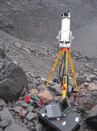 |
| Terrestrial laser scanner |
Technology advantages:
- remote data collection without personnel sccess into dangerous areas
- high accuracy and density of collected data
- high productivity of the survey
- easy creation of detailed 3D models
- significant cost savings comparatively to conventional surveying
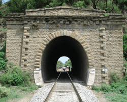 | 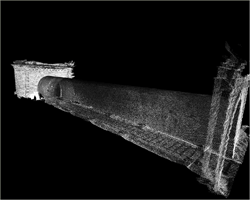 |
| Digital image | Cloud of laser points |
© 2008 Geokosmos


